geocoder-for-google-sheets
Google Sheets Geocoder
Geocode addresses into latitude/longitude coordinates inside Google Sheets, with US Census or Google Apps service
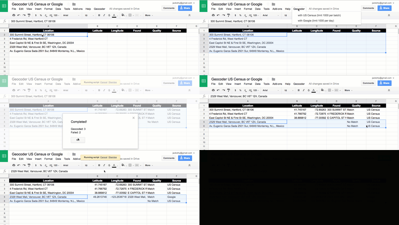
Demo Geocoder US Census or Google
- Geocode locations into latitude, longitude, with source and match quality, inside a Google Sheet
- Go to Google Sheet template, sign in to your account, and File > Make a Copy to your Google Drive https://docs.google.com/spreadsheets/d/1XvtkzuVyQ_7Ud47ypDJ4KOmz_5lOpC9sqeEDBbJ5Pbg/edit#gid=0
- Insert locations, select 6 columns, and select Geocoder menu: US Census or Google (limit 1000 daily per user)
- Google Sheets script will ask for permission to run the first time

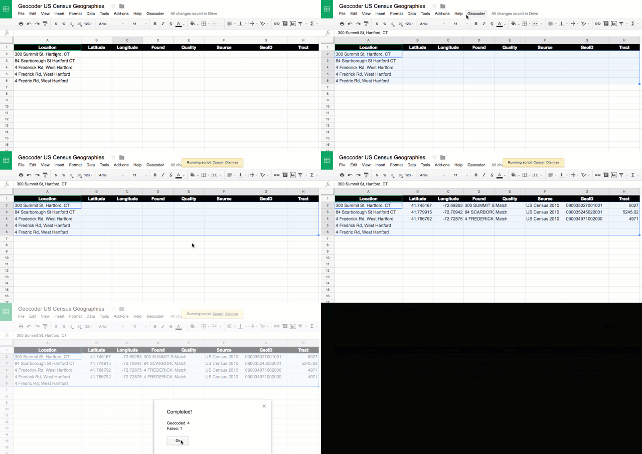
Demo Geocoder US Census Geographies
- Geocode US addresses into latitude, longitude, GeoID census tract, inside a Google Sheet
- Go to Google Sheet template, sign in to your account, and File > Make a Copy to your Google Drive https://docs.google.com/spreadsheets/d/1x_E9KwZ88c_kZvhZ13IF7BNwYKTJFxbfDu77sU1vn5w/edit#gid=0
- Insert locations, select 8 columns, and select Geocoder menu: US Census 2010 Geographies
- Google Sheets script will ask for permission to run the first time

About 15-character GeoID
- Make sure that column G is formatted as text (to preserve leading zeros), not number
- Break down a sample GeoID: 090035245022001
- state = 09
- county = 003
- tract = 524502 = 5245.02
- block group = 2
- block = 001
How to insert script into any Google Sheet
- Download or fork the Google Sheets scripts (.gs) from this GitHub repo
- Go to your Google Sheets > Tools > Script Editor
- File > Create New Script File
- Copy and paste contents of your preferred script (such as geocoder-census-google.gs)
- Save as Code.gs (or save, then rename to geocoder-census-google.gs)
- Refresh your Google Sheet and look for new Geocoder menu
See also: Batch upload to US Census
- Available at US Census Geocoder https://geocoding.geo.census.gov/geocoder/
- Upload up to 1000 rows
- Find Locations using > Address Batch (returns latitude, longitude coordinates)
- Find Geographies using > Address Batch (returns lat, lng, census geographies)
- Upload CSV table with up to 1000 rows for faster processing, in this format:
| AnyID | Street | City | State | Zip |
|---|---|---|---|---|
| 1 | 300 Summit St | Hartford | CT | 06106 |
Learn more
- Data Visualization for All book, see Transform Your Data chapter, http://DataVizForAll.org
Credits
- Developed by Ilya Ilyankou and Jack Dougherty with support from Trinity College CT, for Data Visualization For All
- Inspired by Google Sheets Geocoding Macro (2016) https://github.com/nuket/google-sheets-geocoding-macro (no license)
- Geocoding services:
- US Census Geocoder https://geocoding.geo.census.gov/geocoder/
- Geocode with Google Apps: The Maps Service of Google Apps allows users to geocode street addresses without using the Google Maps API, limit 1,000 searches daily per user, https://developers.google.com/apps-script/reference/maps/geocoder
Testing
- Geocoder-with-Mapzen.gs – need to focus search within a country or prioritize area https://mapzen.com/documentation/search/search/#search-within-a-particular-country